 |
| #1794 "July Sunrise 2016" |
Why do winds shift? The answer to this simple question is important. If one witnesses a shift in the wind, then they will know what it means. Shifting winds also influence the shape of the deformation zone and that is where I am headed. If one observes a characteristically shaped deformation zone, then you will know what the weather is doing. The answer is indeed blowing with the wind! The proof that the above is true is interesting science and it will also allow you to refresh what backing (the wind vector turning counter-clockwise) and veering (turning clockwise) winds mean. I will also suggest a more direct and global alternative to veering and backing that leads directly to the meteorology and is easier to remember.
One of the earliest meteorological lessons includes the phrase “BC VW”. Even scientists use mnemonic methods to remember important things. What this little ditty means is that in the northern hemisphere a Backing wind is associated with Cold air advection, while a Veering wind means Warm air advection. Apparently it also means that there were a lot of Volkswagen vehicles in British Columbia in the 1970’s when I was on Meteorological Course 33 but I doubt if that is still the case.
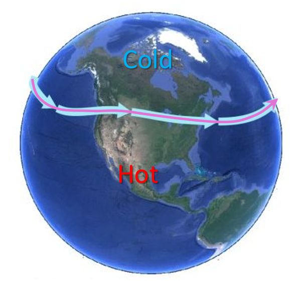
The westerly jet stream is a thermal wind and its speed depends on the temperature difference between the equator and the poles. Right now the poles are heating up much faster (perhaps 10 times faster) than the equator which weakens this temperature difference and in turn diminishes the jet stream. The resultant meandering current of air still guides the weather systems but is changing the climate globally ... alas that is another story for another day - although I have written about it for decades now...

Weather is required to stir these temperatures around and to keep the earth in balance. Warm air is generally moved northward and cold air is directed to the south by weather systems. Heat energy is just one of the quantities that is moved by weather to keep the earth in balance.
Traditionally, wind shear vectors are used to describe thermal advection. The temperature induced wind shear vector is simply the thermal wind and is the large block arrow in the following graphics. A southerly wind vector that moves warm air northward must have the thermal wind shear vector added to it as they occupy the same space. The vector addition occurs over the height of the temperature gradient. This vector addition requires that the southerly wind must also veer (wind vector turns clockwise) with height.
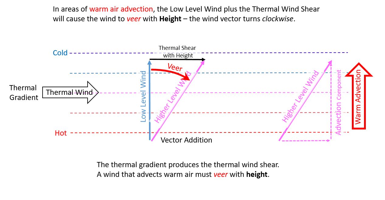 |
| Warm Advection Occurs when the wind Veers with Height |
My simple graphic illustrates this well accepted principle. Warm air is moved northward. Winds veer with height. Heat energy is moved from the hot equatorial source areas to the cold Arctic. The earth stays in balance.
Cold air advection is the exact opposite. Cold air is moved southward. Winds back (wind vector turns counter-clockwise) with height. Cold energy is moved from the cold Arctic source region to the equator.
 |
| Cold Advection Occurs when the wind Backs with Height |
The weather tries to keep the planet in an energy balance. In the above graphics the wind shear is with with height. The strength of the thermal advection changes with time only as a result of the changes in the temperature gradient which must also change the thermal wind.
The following was devised it on night shift in the late 1980s but I was unable to explain the concepts well enough to get acceptance. It is my fault that the following ideas are not mainstream meteorology. But I do not give up either.
Let’s consider wind shear with time. If a wind vector veers with time, the change vector or wind shear must be the result of a thermal gradient at that specific level. The southerly component of the wind vector must advect the warm air northward. With time the southerly component of the veering wind will decrease along with the strength of the thermal advection. The take home message is that wind veering with time must be associated with warm advection although the intensity of that advection must also decrease with time.
 |
| Warm Advection at a Specific Height Level with Time |
The same thought experiment applies equally well for cold advection. Winds backing with time must be associated with cold thermal advection diminishing with time.
 |
| Cold Advection at a Specific Height Level with Time |
This veering and backing of the wind with time does not need to be quantitative in any way. I was simply looking for the qualitative nature of the wind shifts and trying to understand what it might mean.
This work further simplifies the already simple "BC VW" that I was taught on course in 1977 to remember how thermal advection works. This mnemonic was only intended to apply to vertical wind shear in space but I have shown that it applies equally well to time. Further, one can see that cloud lines in the atmosphere also play by these rules. Cloud lines changes with time can reveal many weather secrets.
But wait, there is more. Here is a simpler and global approach to understanding thermal advections that employs your meteorological Coriolis force hand.

These are powerful tools to better understand the weather. I will illustrate them in the next Blog. The answers can be found in the shapes of the deformation zone - my favourite meteorological conceptual model.
Keep you paddle in the water and warmest regards... stay safe,
Phil the Forecaster Chadwick
No comments:
Post a Comment