 |
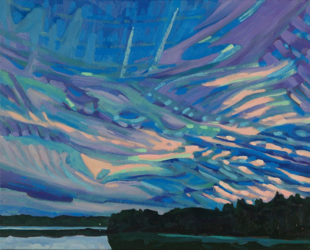
| #2529 "Sleepy Time Sky Story" Looking west into the centre of the DZ Col and the Maw of the Approaching Storm... I love the weather! |
 |
| A Paddler's View of a Stroke in Duckweed |
 |
| A Meteorologist's View of a Stroke in Duckweed |
The deformation zone (DZ) has several stories to tell. And there are also two sides to every line just like there is two sides to every story. A single stroke of the paddle creates one line and four swirls. Each deformation zone line is composed of a col at the centre of the stroke, joining the starting point of the two divergent confluent asymptotes. Companion swirls are found on the opposite sides of the paddle stroke. Sympathetic, paired swirls develop on the opposite sides of those confluent asymptotes as a result of the fluid flow along the confluent asymptotes. In the duckweed frame of reference, these fluid vectors do not average to zero and the canoe (or kayak) is propelled forward. To transform this paddle stroke into the weather of the atmosphere, think of the paddle as moving the warm conveyor belt as it rises along the isentropic surface headed northward.
Deformation zones (DZ) can become your new best friend so please try to follow the explanation. Aside from gravity waves, every line in the atmosphere is indeed a deformation zone. The shape and location of every DZ must also reveal the relative intensities and location of each of the four swirls - and that tells you everything about the weather.
All of this bears repeating.. just in case you missed it the first time. Here is another way to look at the duckweed lines and swirls.
Since the deformation zone is the leading edge of the flow… and if this flow is moisture laden .. we can see the cloud associated with the warm moist air rising along the isentropic surface. By examining the swirls, we can also deduce which portion of the storm is aimed at our location at that moment. The cyclonic companion has a more upward and unstable flow and thus more weather. The anticyclonic companion has more downward and stable flow and less weather.
Which swirl companion is directed toward you is typically best revealed by watching the motion of the clouds on the moist side of the deformation zone - there will be more to watch and study on the cloudy side of the line. This step will also reveal the relative location of the col in our field of view. Get ready to point the fingers of your Coriolis Hand in the direction that the cloud is moving.

A similar discussion applies if the cloud is moving to the left along the moist side of the deformation zone - but you will be looking at the anticyclonic companion flow. Try it out.

 |
| Wind Waves Superimposed on Swells |
Wind gravity waves in the clouds can also reveal the direction of the flow in a painting such as that above when animation is not possible. Locally stronger winds will be found along the confluent asymptotes. As described in the previous Blog "Seeing Even More Gravity Wave Clouds", the wind gravity waves generated by stronger winds, must also have a longer wavelength. This will cause the wind gravity waves to appear to twist downwind along the deformation zone or embedded within the swells.
 |
| #2529 "Sleepy Time Sky Story" Further Practice available on the Painting Reality can be more complicated than my graphics |
Keep you paddle in the water and warmest regards...
Phil the Forecaster Chadwick
3 comments:
I’ve been clicking around your blog posts, feeding new terms into my brain spaces. Does the term "pure cyclonic rotation in the atmospheric frame of reference " refer to the earth's rotation? And do most of these posts refer to storms…as opposed to calm? Some pretty crazy and exciting skies today on the Niagara Frontier and I am beginning to understand some of the shapes better due to your lessons.
I’ve always been a cloud watcher. We had them all today, from dark bottomed deep and tall fluffy cumulus to cirrus to wispy to solid gray walls of cold that sent me home.
Kath
I am sorry Kath - just seeing your question. The pure cyclonic rotation I was referring to in the atmospheric frame of reference results from motion on a spinning globe through the Coriolis force. Storms are associated with cyclonic rotation - rising air - use your Coriolis hand, pointing your fingers in the direction of the flow and your thumb points up. Clear skies are associated with anticyclonic rotation - sinking air - less cloud if not clear. The weather can be the friend of us artists in more ways than just on the canvas :>))
Post a Comment