Sunday, February 27, 2022

Meteorology Meets Oceanography

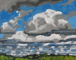
#0135 "Tiger on the Prowl"

Energy is neither created or destroyed… but energy is often converted from one form into another. In "Adding Friction to the Wind Balance" I described how friction with the earth in the planetary boundary layer (PBL) would always turn the gradient wind (see "Another Look at the Wind") toward lower pressure. Your Coriolis arm would turn toward lower pressure with increased friction and if you kept your thumb pointed in the direction of the pressure gradient force, the angle between your thumb and fingers would get smaller with increased friction. 

Summary Explanation of the Gradient Wind,
Friction and your Coriolis Arm

Vagn Walfrid Ekman (1874 – March 1954)
But I did not mention Vagn Walfrid Ekman! Yet... Dr Ekman (1874-1954) was a  brilliant Swedish oceanographer as well as a musician. Art and science are once again intertwined. The Norwegian explorer Fridtjof Nansen was the science officer on the voyage of the Fram 
1893–1896 which was tasked to reach the geographical North Pole by harnessing the natural east–west current of the Arctic Ocean. During the expedition, Nansen observed that icebergs tended to drift not in the direction of the prevailing wind but at an angle of 20 to 40 degrees to the right. Hmmm. Bjerknes invited Ekman, still a student, to investigate the problem. Vilhelm Bjerknes you might recall, could be called the father of modern meteorology as he formulated the primitive equations that we use in  meteorology and numerical weather prediction. Vilhelm and his son Jacob figure prominently in "Weather Dances" where I discus their Norwegian cyclone model and the military terms used therein since they did much of the work with the backdrop of World War One. 

Anyway, in 1905, Ekman published his theory of the Ekman spiral. His theory explains the  balance between frictional effects in the ocean and the Coriolis force which exists because we live on an non-inertial frame of reference - the spinning planet. 

The science of meteorology and oceanography were incredibly intertwined more than a hundred years ago. 

Now back to the energy conversions to drive this point home. The wind energy of the free atmosphere is transformed by friction with the earth’s surface into angular momentum of the earths rotation (more on this in another blog). In addition, as the wind approaches the rough surface, your wind balanced Coriolis arm turns toward lower pressure and the wind speed decreases with that energy shoving the earth along. This is the Ekman spiral in the atmosphere as pictured above using my waving hand and arm. 

Oceanographic Ekman Spiral
where
1 is the friction PBL wind,
2 is the force from above,
3 is the direction of the resultant current
 (vector addition) and
4 is the Coriolis force 
When the atmospheric winds lower to the surface of the ocean, simply another fluid, that energy of wind motion is transferred to the water. The frictional driven water current is deflected by the Coriolis force - to the right in the northern hemisphere.  There is a net current to the right of the PBL wind. Along coasts, the net loss of surface water can  result in a secondary upwelling current. These coastal upwelling Ekman driven current explains the famous fisheries around the globe.  

The water brought to the surface from the depths is typically  rich in nutrients that support the coastal ecosystems. Declining oxygen with climate change is starting to counter these benefits. 

The energy of the atmospheric wind can drive the energy of the oceanographic Ekman spiral which in turn (so to speak) drives the coastal upwelling which encourages the fishery and feeds nations. Nothing is lost and all is sustainable IF this energy and these resources are managed wisely. 

Ekman driven Upwelling
Everything is connected...

Oceanography and meteorology are sciences of fluids on a spinning globe. Both are vitally important to the welfare of the planet and the creatures that share this garden of Eden. I have been a life long member and supporter of the Canadian Meteorological and Oceanographic Society. We are all in this together… air, water and sometimes even rock are fluids. Maybe we should add volcanology to the society of fluid sciences as well!

Warmest regards and keep your paddle in the water,

Phil the Forecaster Chadwick


Monday, February 21, 2022

Applying the Gradient Wind Balance... To Shovel or Not to Shovel... that is the Question

0519 "Homestead -West Wind"
Home and Watershed Farm in 1993

Happily, most of my career with Environment Canada spanned what I think of as the Golden Age of Meteorology – before technology took over. 

Map Analysis 1977
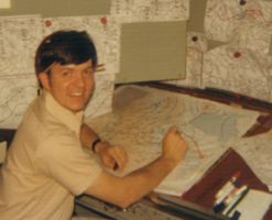
The forecast cycle was still a largely human exercise in the 1970’s. There was still so very much to study and humans learn by doing. The first step in every shift was to do a thorough weather analysis. I drew isobars on coloured maps with a terrain background. I had a plastic pocket protector full of coloured pencils and markers. The data had been hand plotted by an expert technician. The surface chart was a work of both art and science upon completion. The patterns revealed the current weather situation and the “concern of the day”. The team would concentrate on predicting the most important weather elements for the coming days. Life was very good, fun and full of challenges.

Some of the fruit from that Golden Age of Meteorology has been the remarkable numerical simulations of the atmosphere of today. The Numerical Weather Prediction (NWP) ingests far more data and completes billions of calculations beyond what humans can do. The essential super computers produce remarkably accurate forecasts that span space and time around the Globe. Meteorologists use these tools to aid clients in the increasingly weather sensitive society. But it is still important that humans understand the nature of weather and that leads back to these posts. 

The past few Blogs described how to interpret those isobars on the surface map and the height contours on the upper air charts. 

We started with the Geostrophic Wind Balance and then added in the centrifugal force to achieve the Gradient Wind Balance. See "The Answer Really IS Blowing in the Wind" and "Another Look at the Wind". Finally we added in friction to understand what happens to the wind in the planetary boundary level (PBL) where we all live. See "Adding Friction to the Wind Balance". After those Blogs, we have a basic understanding of the wind. 

Hand analyses are generally a thing of the past. The computer generated surface pattern from this past Saturday can still reveal what one needs to know. Blowing and drifting snow will restrict transportation and close schools as effectively as a general snowfall. To forecast those events can be complicated as it depends largely on the characteristics of the snow surface. The wind is the key factor though and those last three posts has gotten us to the point to answer those questions. 

The geostrophic wind based on the extremely tight spacing of those isobars alone, would be an under-estimate of the real gradient wind. The isobars over the lower Great Lakes are nearly straight if not curved anticyclonically. 

The observed winds for the same time as the surface chart show winds blowing on average of 45 degrees across the isobars toward lower pressure - the influence of friction. 

850 mb Height Contour Chart for about the same time.
 Note that the winds at about 5000 feet above the surface
away from friction, closely follow the height contours.

The important forecast was that Saturday was going to be a very blustery day with south to southwest, gusty winds. For me that meant that I would not bother to shovel the lane or sidewalk as the snow would just drift back into place. I painted in the Singleton Studio instead. 

Now we know the wind... and that  information can guide us in our decisions. 

Warmest regards and keep your paddle in the water,

Phil the Forecaster Chadwick


Monday, February 14, 2022

Adding Friction to the Wind Balance


#0839 "Cold Air Mass Cumulus"

There are four forces required to really understand the wind. 

  • The pressure gradient force (PGF) varies with the contrast in pressure and points toward low pressure. 
  • The Coriolis force defects moving parcels to the right (Northern Hemisphere); varies with the speed. 
  • The Centrifugal force varies with the curvature and always points toward the centre of that curvature. The Centrifugal force influences the relative strength of the gradient and geostrophic balances. 
  • Friction turns the wind to lower pressure… the more friction… the more turning. 
The PGF, Coriolis and Centrifugal forces determine the wind in the free atmosphere. Friction is important in the Planetary Boundary Layer (PBL) but all of the forces are required to understand the wind near the earth's surface.  

The Wind Balance of Forces including Friction

"Another Look at the Wind" explained how to use your Coriolis arm to understand the wind in the free atmosphere. We can use that same approach to understand the influence of friction in the PBL. Friction simply slows the air down. A rough surface like a forest is more effective than a lake in slowing the wind down. Using your arms and body to approximate the balance of forces to create winds is another reason why weather is a ballet.. a dance and not a battle.

Consider your Coriolis Arm that is attached to your Coriolis Hand. Align your arm with the gradient wind at the top of the PBL. Hold your Coriolis Hand outward with your fingers pointing in the direction of the gradient wind, your palm facing down and your thumb stretched at 90 degrees. Your thumb must point in the direction of the pressure gradient force (PGF) at all times. As you descend toward the earth's surface (in your mind), you start to encounter friction. The wind slows down but wants to stay in balance. The wind tries to keep blowing as fast as it did by turning to flow more toward the low pressure - down the pressure mountain. Your Coriolis arm will turn toward the lower pressure but keep your thumb pointing in the same direction that it was at the start - the direction of the PGF.  The effects of friction is approximated by the angle that your thumb makes with the rest of you Coriolis arm and fingers.

Your Coriolis Arm Can Illustrate 
the Impacts of Friction Too

In the homemade graphic, the gradient wind in the free atmosphere is in the top left. As one descends toward the ground, the Coriolis arm gets progressively obscured.. maybe it was a foggy day? The Coriolis arm on the lower right is at the ground level where we all live. 
Now we know the wind... 

Warmest regards and keep your paddle in the water,

Phil the Forecaster Chadwick

Monday, February 7, 2022

Another Look at the Wind

#2009 "Algonquin Rock Lake Turbulent Sunrise"
Looking back at this plein air painting, I see
that I painted my Coriolis hand into the
cold advection, turbulent stratocumulus. 

The geostrophic and gradient wind balance equations can be a challenge even for meteorologists. The fundamental forces that move the air around the Globe are not something that we think about every day. There is no time during any shift to go back to first principles when preparing a forecast for the next week for large areas of Canada. 

To be clear, what I am attempting to do in these Art and Science Blogs, is explain nature in a way so that even the most challenging concepts are understandable. It is a task I have set for myself and I link the ideas with phenomena that I observe in my artwork. Science should make sense and if I can’t explain something, then I must not really understand it well enough. Being naturally curious can be a full-time occupation - even when retired I need to brush up on the science and learn it better. 

I rely on visual aids when explaining things. Many of these explanations, especially meteorological ones, are hand-waving exercises. I do not go anywhere without my Coriolis Hand! The Coriolis Hand can be used to explain much about living on a rotating planet. 

Gaspard-Gustave de Coriolis of Paris (1792-1843) was an engineer and mathematician who first described motions on a rotating body deflected by an apparent force that now bears his name. If you place your Coriolis hand palm down and point your thumb in the direction of the motion, the moving substance will be deflected in the direction of your fingers. Your right hand is your Coriolis Hand in the Northern Hemisphere while south of the equator, it is your left hand. 

We can also use the Coriolis Arm which is attached to your Coriolis Hand, to explain the geostrophic and gradient wind balances detailed in the last Science Tuesday. I keep trying to elucidate things in different ways until the concepts connect. Everyone learns in their own unique way. 

The Geostrophic and Gradient Wind Balance Graphics

Instead of analysing the vector diagrams like we did last week, align your Coriolis Arm with the gradient wind at the top of the planetary boundary layer (PBL) - where there is no friction. Hold your Coriolis Hand outward with your fingers pointing in the direction of the gradient wind, your palm facing down. If you stretch your Coriolis thumb at 90 degrees to your fingers, your thumb must point toward lower pressure and in the direction of the pressure gradient force (PGF).  The Coriolis force deflects every moving thing to the right in the Northern Hemisphere. The centrifugal force always points way from the centre of curvature. 

The following graphic summarizes these three forces - pressure, Coriolis and centrifugal using your own Coriolis Arm. It also explains that due to the centrifugal force, the gradient wind is weaker than the geostrophic wind balance in a trough but stronger in a ridge.  My Coriolis arm only bends cyclonically when I am relaxed and one would expect the gradient wind in a trough to be more calm as well. 

Understanding the Wind Using you Coriolis Arm
View looking down from space

You can use your Coriolis Arm in reverse as well. Point your Coriolis fingers in the direction of an observed wind revealed by gravity waves, swells or Langmuir Streaks. Your stretched thumb must point toward lower pressure. If the wind is strong, the pressure gradient is also steep. All of these facts can tell you something about the weather. 

Next Science Tuesday we will add in the fourth important force of friction so that we might better understand the wind in the planetary boundary level as well. Bring your Coriolis arm too. 

Warmest regards and keep your paddle in the water,

Phil the Forecaster Chadwick