Saturday, August 12, 2023

Connecting with Nature

 "The Connecting with Nature, Oak Ridges Moraine" art book received the 2009 Moraine Hero Award for demonstrating remarkable efforts in protecting the Oak Ridges Moraine. Several other King artists were involved in this wonderful book that Herbert Pryke designed.

Herbert asked for submissions from artists living on the Oak Ridges Moraine to assist with this project. 

At the time we were living on the very crest of the Oak Ridges Moraine along the 12th Concession of King Township. The front yard drained to Kennifick Lake (a kettle lake), thence northeastward via the Schomberg River to the Holland Marsh and ultimately reaching Lake Simcoe via the Holland River. The back 25 acres fed into the Humber River. Watershed Farm started as an abandoned century-old farmhouse and evolved into a jewel of conservation and natural beauty - at least in our eyes. I loved Watershed Farm ... the honey bees, turkeys, deer and even the opossums migrating northward with climate change trying to find a place to live. Life was good and always very interesting. We planted lots of trees too including many black walnuts!

In 2009 the Oak Ridges Moraine was under the threat of unchecked and rampant development. Artists banded together to do their best similar to the story of how A.Y. Jackson and the Ontario Society of Artists contributed to the creation of Killarney Provincial Park. 

I submitted two plein air pieces painted on Watershed Farm for consideration by Christine A. Lynett, Manager, Programs, McMichael Canadian Art Collection. They were from the same location but completed in very different seasons. 

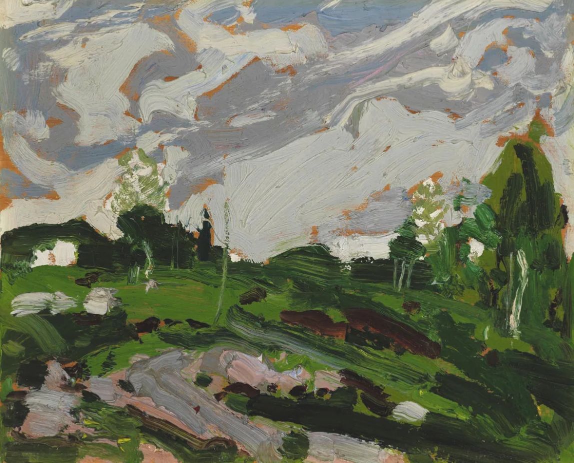
#0879 "The Copse" 11x14 oils on canvas

#0610 "Wild Life" 16x20 oils on canvas
The first time I froze my hands...

Christine wrote: "Congratulations on being selected for the Oak Ridges Moraine Book -I loved your work and I chose both the autumn scene (879-this one) and the winter fence (0610) scene ... the works really stood out especially the colour in THE autumn scene ... the use of brushstroke and composition in both with horizon line near top were very engaging."

 "The Copse"  as it appears in
"Connecting with Nature, Oak Ridges Moraine

Herbert remains a good friend and continues practising his altruism to the benefit of all - currently in Owen Sound. 

Sadly, the Oak Ridges Moraine is once again under attack. Investigative journalists and the Auditor General are doing their best to discover the truth behind the backroom political deals made behind closed doors. Concerned citizens from every walk of life are taking part in an effort to preserve an irreplaceable and essential environment thousands of years in the making. 

The Greenbelt is not a scam as Premier Ford claims and the issue is not about housing as Minister Clark insists. If you must, plan a sustainable city of the future instead of an obsolete suburb of the past. The Conservation Authorities that recently suffered severe budget and mandate cuts were born out of the devastation from Hurricane Hazel of October 1954. Politicians have long forgotten those valuable lessons while citizen scientists have not.  

Apparently, power does corrupt and this latest threat to the Oak Ridges Moraine is simple greed to satisfy the lust of a few at the expense of everything else. Nature does not even have a voice. Shame... 

Become informed... the issues need not be complex. Simple right and wrong suffices. It is important to separate political spin from facts and accurate history. 

The Narwhal is a reliable source for  News on Climate Change, Environmental Issues making sense of the key environmental issues in Canada. The Narwhal: https://www.thenarwhal.ca

Also consider: Actions to Fight Bill 23 

Warmest regards and keep your paddle in the water,

Phil the Forecaster Chadwick


Friday, May 26, 2023

Artificial Intelligence.. the Weather and Art

Artificial Intelligence (AI) is epidemic. A host of mimicking software algorithms “learning“ from the volumes of recorded history will impact society - perhaps change it forever. We shall see...

There are many questions as to what those influences might be. Aldous Huxley had opinions that he documented almost a hundred years ago. Legislators in Europe are racing to get ahead of the technological curve.  Tech giants are sprinting to develop Artificial Intelligence applications and get them accepted into society before that happens thus making any legislation irrelevant and reactionary. Asking for forgiveness versus permission are very different things after the cat of AI is already out of the bag. 

2017 Was a Big Year for AI performing better than     
humans for the first time in several key categories. 

The materials used for learning include everything and anything that can be digitized. Many collaborative Artificial Intelligence algorithms team up within the huge and ever-growing black box of code to establish patterns from those enormous data sets. The software can appropriately reproduce these patterns upon request - more or less. 

Meteorological models are early examples of Artificial Intelligence. When I became a meteorologist in 1977 one of my managers told me to look for another line of work as my career path would be automated within the decade. Moore's Law from 1965 observed that the number of transistors on computer chips doubled approximately every two years. The computerization of society followed and it would appear that the impact of that digitization of knowledge has been exponential in growth ever since.

Meteorological simulations of the atmosphere leapt forward in precision and accuracy in both time and space during my career. A keen meteorologist in the early 1980s could easily improve on the barotropic model available as guidance in that era. By Y2K (the year 2000 when the world was worried about the coding of the date using just two numbers to identify the year), computer models of the atmosphere were the state of the meteorological art and they have only continued to improve in the last twenty years. 

The human hand analysis of weather maps was actively discouraged within the weather centre after Y2K. There was no time dedicated to that essential and very human effort of drawing lines and deciphering coded data into meaningful patterns. The hand analysis synthesized the wealth of coded data and human experiences into a personal understanding of the current weather situation. The important weather concerns of the day were discovered and the team got to work creating products to alert the clients affected. Producing an accurate forecast requires understanding the important meteorological forces at play. 

An AI limerick created up on the request
of my fellow meteorologist and
 friend, Jim Murtha

By the time I retired in 2011, computer simulations of the atmosphere were good enough that meteorologists could maybe not even bother conducting an independent analysis and diagnosis in order to produce a prognosis. Available time on shift was increasingly restricted and very limited for that effort anyway. Proper measurement of that forecast performance is still elusive but that is another story based on the scales of time and space as well as forecast lead-time. That Performance Measurement research of mine never got implemented... 

It took 30 years for the forecast made by my first manager to verify but his recommendation to find other work was still apparently correct. I became an artist...

My concern is that brain "muscles" only develop with some heavy lifting. If all you are doing is repackaging AI, then one can expect to become feeble-minded. Apparently, Aldous Huxley felt the same way. 

Vincent van Gogh art "created" by
https://creator.nightcafe.studio/
The nested algorithms of AI can reproduce the genius of Einstein, Van Gogh and Tom Thomson with a keystroke. There are reasons to be alarmed and very skeptical and perhaps disbelieving. What indeed is real and what is the product of nested algorithms feeding on all of human experience? That tipping point happened a couple of decades ago in meteorology.

There are options though...

In art, the solution is to take the path not only less travelled but never trod upon before. Paint on and dam the algorithms. Maybe not even post your art because once you do, it can be assimilated by AI.

In meteorology, focus on looking at the real world. The techniques I describe in my Tom Thomson blog can be applied to any skyscape to better understand the real clouds and the actual weather. It is also fun to be outside surrounded by nature. Become a "weather walker"... 

Artificial Intelligent "Painting by Tom Thomson" is 
fortunately not even close (yet) but it tried...

It is time to re-read Brave New World by Aldous Huxley published in 1932. Aldous was right. As Huxley remarked in Brave New World Revisited published in 1958, the civil libertarians and rationalists who are ever on the alert to oppose tyranny "failed to take into account man's almost infinite appetite for distractions."

First Edition Cover from 1932

Seeing is believing is no longer possible with Artificial Intelligence. Beware of geeks bearing gifts... Boldly go forging your own unique path through life while enjoying that ride - it might be the only thing you can actually believe and appreciate. 

Warmest regards and keep your paddle in the water,

Phil the Forecaster Chadwick

PS: AI based on history often fails in situations that have not yet been observed. The now historic Progressive Derecho of Saturday, May 21st, 2022 was a bust forecast that impacted roughly 15.6 million people, representing about 41 percent of Canada's population. Strong winds downed over 1,900 hydro poles, five metal transmission towers, and countless trees along the path. There were 5 fatalities. The EC Warning Program had challenges. 

Friday, March 3, 2023

Empathetic Meteorology

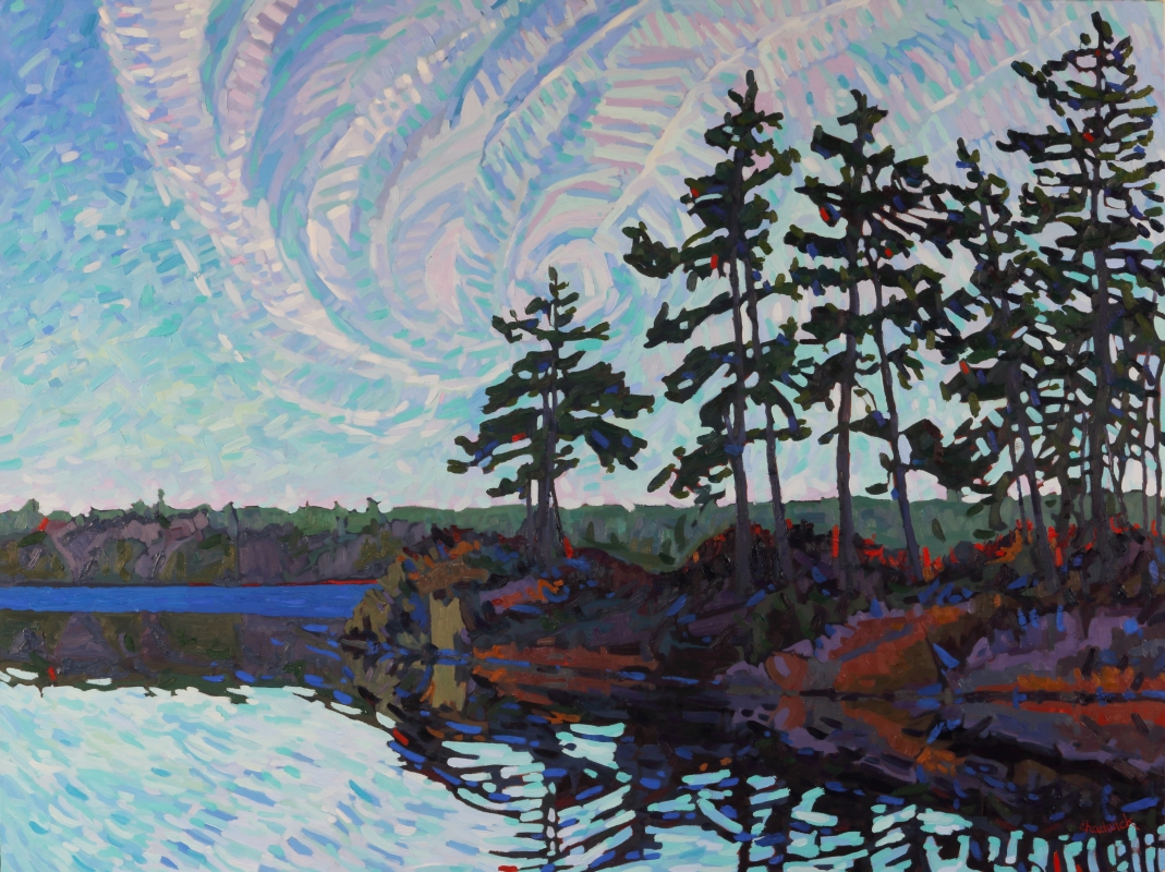
#1714 "White Pine Island"
Cloud Patterns within the Atmospheric Frame of Reference
and what they mean

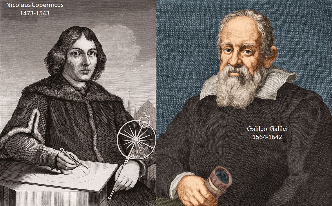
Empathy is important. It is vital to examine a process from the appropriate point of view in order for it to make the most sense. Humans are anthropocentric by nature - which is very unnatural! Ask Copernicus and Galileo about the challenges they faced - great minds who dared to think outside the proverbial box encountering obstacles beyond belief. 

Copernicus developed heliocentrism in 1514 that the Sun and not the Earth was the centre of the "Universe". It was published the year he died. Galileo Galilei (1564-1642) the father of modern science, agreed with Copernicus. Galileo was convicted of “vehement suspicion of heresy” and under threat of torture from the Church. Galileo was forced to express sorrow and to curse his errors .. but I digress... 

Meteorology in Canada flourished out of a necessity for safer air travel - simply to avoid storms. Aviation requires a frame of reference attached to the airports and constant pressure surfaces. A fluid on a rotating, oblate spheroid like the Earth does not care much about any of that. Fluids can be better understood following an empathetic frame of reference moving with the fluid. 

Air parcels follow constant energy surfaces (isentropic surfaces) fuelled by contrasting temperatures between the equator and the poles (see "The Jet Stream - The Bind that Ties"). The average westerly winds of the jet streams in both hemispheres move the storms along but what shapes those patterns? The answer is indeed blowing in the wind and using a frame of reference attached to the storm. 

The purple local wind maximum spins up two, adjacent
 companion swirls

A puff of stronger wind (local maximum in the jet stream and the purple vector in the accompanying graphic) creates two paired vortices. The so-called "cyclonic"  or vorticity maximum (red X) is poleward of the jet maximum (in the northern hemisphere to the left looking downstream). By meteorological convention, the "anticyclonic" or vorticity minimum (blue N) is equatorward of the jet maximum (to the right looking downstream in the northern hemisphere). Use your Coriolis Hand to visualize these paired rotations - your right hand for the Northern Hemisphere and the left hand for Down-under.  

These paired circulations are simply cross-sections through the three-dimensional smoke ring blown by the local jet maximum but this blog is more about the patterns caused by the rotational swirls as viewed in the empathetic, atmospheric frame of reference. (See "What do Smoke Rings have to do with Croquet?" for the three-dimensional  approach)

The shape of the moisture patterns is determined by simple vector addition: 

  • the relative strength of the local wind maximum which determines the rate of rotation of the accompanying swirls; and
  • the speed at which the swirls are being translated along by the jet stream.

I did this work on a night shift sometime in the early 1980s. I saw a pattern in the newly available satellite imagery and simply asked "why?" The real atmosphere was the best teacher I could have hoped for. 

The following graphics are the same for whatever speed we wish to assign to the local wind maximum. The associated weather is of course more intense with the stronger jets. 

In "Rotation is the Key to Unlock Cloud Shapes" I explained how the cyclonic swirl in the atmospheric frame of reference formed an open trough in the Earth Frame. 

The open trough became deeper as either the cyclonic swirl (green vectors within the green box) increased in speed or the speed of translation of the system decreased (purple vector attached to the purple circle). Open troughs generally move quickly and are not associated with surface low-pressure areas - both observations relative to the Earth frame. Open troughs typically produce clouds in the free atmosphere but no precipitation. 

When the vectors of the rotational swirl match the 
translational vector, an incipient low is about to
form in the Earth frame of reference -
the same low-pressure area that
meteorologists analyse on weather maps. 

As the speed of the swirl increases more that the speed of system translation, the location of the low on the weather map shifts in the direction of Coriolis Deflection (to the right in the northern hemisphere). In those situations when the system translational speed reduces to zero, the low in the Earth frame of reference must be collocated with the cyclonic swirl in the atmospheric frame.

The clincher is that the centre of the swirl in the atmospheric frame of reference is exactly the centre of the moisture swirl that we witness in satellite imagery - and that is the relative vorticity centre using meteorologist lingo. That is what I discovered on that night shift while closely examining the grainy, hard-copy infrared satellite image. It was a eureka moment for me that would define most of my meteorological life. 

The swirls in the satellite imagery could be analyzed as vorticity centres. Vorticity centres were a staple of the products found in numerical simulations of the atmosphere. Comparing the location of the vorticity centres in the real atmosphere with those in the numerical, simulated atmosphere could lead to improved predictions especially when strong vortices were involved. 

It was really that simple. My goal was to teach this at Training Branch back in the mid-1980s. I was not successful then but did have some success eventually in Boulder, Colorado at COMET. Some of this work can be found within the COMET online material and it is all free - so the price is very right. I have reproduced some of that material in these blogs because it is so very important in order to understand cloud shapes. See "Cloud Shapes from Rotation" for more on this. The additional influence of wind shear that spins up swirls is required to make a cusp in the cloud formation. 

The identical process can be described for the anticyclonic swirls. 

Open anticyclonic ridge - fast-moving fair weather

Incipient High in the Earth frame of reference when the rotational
speed of the anticyclonic swirl is the same as the speed of translation

The location of the high-pressure centre shifts in the anti-
Coriolis Deflection direction (to the left in the northern
hemisphere) as the speed of translation diminishes
to zero and the high-pressure centre analyzed on the
weather map in the Earth frame of reference is collocated
with the anticyclonic swirl.

Clouds make so much more sense if we use an empathetic eye and watch them from the atmospheric frame of reference. Cloud lines and patterns shaped by the swirls can be easily understood.
The red “X” is considered to be positive or cyclonic (counter-clockwise in the northern hemisphere) rotation of the atmosphere. The resultant cloud edges are actually two cyclonically curved arcs that meet smoothly at the centre of rotation. Pointing your right thumb upward at an “X” also points your fingers in the direction of the cyclonic rotation of the atmosphere.

The following animations might assist you to unlock the door of understanding for you...

The point of inflection is not smooth but becomes a cusp when speed shear rotation is added into the mix. In the following animations, the red X of the vorticity centre is between the two components of pure rotation "R" and shear "S". Both rotation and shear cause the atmosphere to swirl. 
As the wind shear component "S" increases, the sharpness of the cusp increases correspondingly. 
If you practice this just a few times and take the opportunity to watch clouds develop and move, you will quickly begin to understand cyclonic cloud shapes. Follow the cloud edges cyclonically to the cusp where the curvature of the arc changes. The cusp is your centre of rotation; the relative vorticity centre; the swirl and where you begin your empathetic view of the atmospheric moisture.
Exactly the same can be done for so-called anticyclonic circulations except that everything is mirrored in reverse.  Anticyclonic circulations are typically associated with descending air and thus fewer clouds- but the weather is still very important. 

Looking back, this work on the centre of swirls seems intuitively obvious. At the time, it was anything but and the challenges were many and varied. A background in art certainly was beneficial to visualize the atmospheric motions from its frame of reference. In the early 1990s with vastly improved satellite imagery,  I attempted to translate that data with the mean translation. The goal of "King Atmosphere Relative Display" or KARD was to further prove the concepts and assist others to see the bumper car aspects of atmospheric interactions. Some of the effort was completed at the King Radar site near Watershed Farm but again the challenges were large and  I had to resort to hand waving.  

I did so much hand-waving in my time that it became more like bad break-dancing. I never tired of attempting to explain the beauty and simplicity of the weather. I guess I have yet to stop trying as I still empathically have my mind up in the clouds within their frame of reference. I also have more time now to take my paints along with me for the ride. 

There is much more that I could explain but this is enough for now. I hope you can get outside with your Coriolis Hand and watch the clouds go by and appreciate them even more... 

Warmest regards and keep your paddle in the water,

Phil Chadwick

Friday, December 2, 2022

Lines and Swirls Explained

#2713 "Curly Hook Cirrus Sunset"
14x18 inches oils on canvas

As the world paves over paradise, may I suggest that you surround yourself with nature? The sky for doing so is the limit or so the saying goes. Actually, the sky has no limits for natural inspiration and perhaps I might be of some assistance. The sky is always available and all you need is time. 

Start by watching the patterns move across the sky. The translation of the clouds does not have to impact the shapes. The average wind simply moves the clouds along. Without water vapour, the circulations are quite invisible but they are still there.  

Recall that moisture is shaped by relative motions within the atmospheric frame of reference. I have written about this many times but "Down to Earth Meteorology" is a good summary.  Absolute location to another reference frame such as the Earth only makes the patterns harder to comprehend. The shapes reveal the wind and those patterns are readily understandable in terms of lines and swirls. The answer is indeed blowing in the wind. Bob Dylan’s 1962 anthem posed some rhetorical questions about peace, war, and freedom and sixty years later, those elusive dreams have still not been attained. In the example of the atmospheric frame of reference, there is a solution though. All patterns within the atmospheric ocean evolve from that simple puff of wind along with smoke rings. 

I reiterated the foundation for this work in my previous blog, “A Jet Streak with a Paddle”. This current blog will assemble those parts in terms of lines and swirls. I will follow that with the easiest atmospheric example - mare’s tail cirrus.  After that, you are ready to understand every cloud in the free atmosphere – almost anyway. 

The Deformation Zone Conceptual Model complete with
Coriolis Hand Orientations - for reference looking down

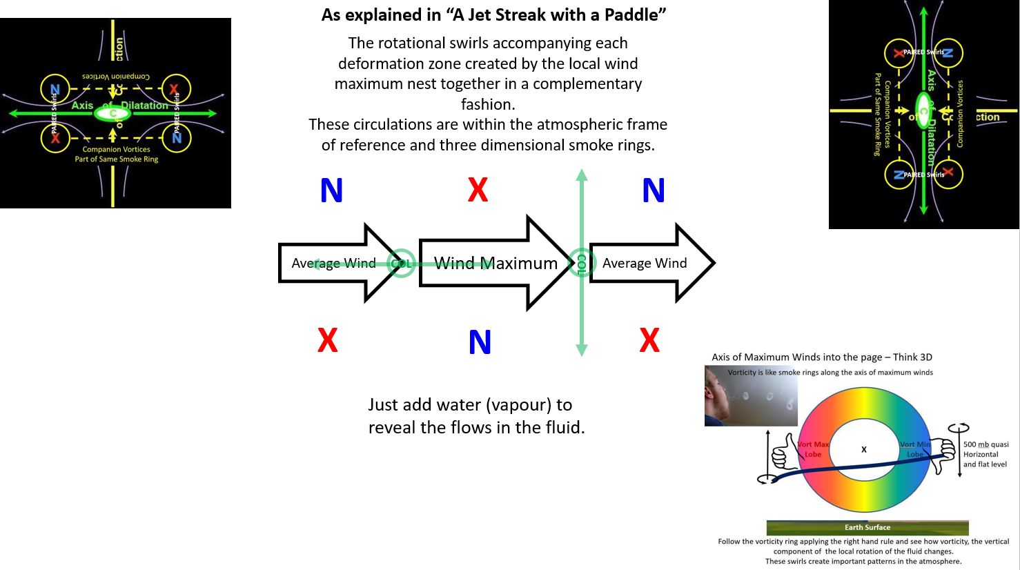
In “A Jet Streak with a Paddle” we established:

  • The col of the deformation zone (DZ) is located where the rate of speed increase or decrease is the strongest. 
  • The deformation zone (DZ) associated with a speed increase must parallel the flow.
  • The deformation zone (DZ) in an area of speed decrease must be perpendicular to the flow.

Looking Down as in a Satellite View


The Swirls of the Deformation Zone Conceptual Model 
can be added to the lines. You cannot have lines
without the swirls


Smoke Rings are the Three-Dimensional Manifestation
of the Local Wind Maximum. The Visible Smoke Ring
related to the Companion Swirls associated with the 
wind maximum

Cirrus cloud is almost always in the sky for our entertainment. Cirrus is much more exciting than most meteorologists give it credit for. This post and “A Jet Streak with a Paddle” will allow you to understand what the lofty cirrus has to say.

Cirrus uncinus is a special type of cirrus cloud. The word "uncinus" is derived from Latin, meaning "curly hooks". Also known as mares' tails, these clouds are generally sparse in the sky and very thin. The clouds occur at high altitudes, at a temperature of about −50 to −40 °C. They are generally seen when a warm or occluded front is approaching. They are also shaped by the relative wind!

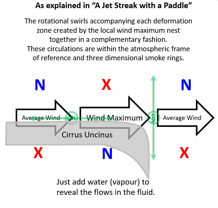
The curl at the end of the band of cloud is associated with a decrease in wind speed. Within the atmospheric frame of reference, a decreasing wind speed requires deformation zones perpendicular to the direction of the flow. 
Looking Downward on the Curly Hook Cirrus Pattern
In order for the speed to decrease, somewhere upstream the wind must have increased in speed as compared to the average flow of the atmosphere. If the speed of the flow increases, the deformation zones must parallel the direction of the flow. The fingers of your Coriolis Hand when aligned with the curl of the cloud, reveals if the moisture is associated with the cyclonic or anticyclonic companions of the atmospheric flow. 

Typically moisture is found on the warm side of the jet stream. This corresponds to the anticyclonic companion. You might notice that the majority of the mare’s tails are anticyclonic swirls. The wind decreases at the end of each mare’s tail necessitating the axis of the deformation to align perpendicular to the flow.
Painting Looking Upward

You can also monitor the drift of the cloud by the average wind. Using your Coriolis Hand, you can determine if the drift relative to the average wind is either cyclonic or anticyclonic. Point the fingers of your Coriolis hand in the direction of the drift as you watch the approaching cloud.  If the drift is toward your left, your Coriolis thumb points downward and you are watching the anticyclonic companion of the deforming flow.  If the drift is toward your right, your Coriolis thumb points upward and the cyclonic companion is headed your way. Your right hand is your Coriolis Hand in the northern hemisphere. This is another application of the deformation zone conceptual model when the wind aloft is decreasing in speed. If there is no lateral drift in the cloud patterns, then the wind is increasing over you. I wrote about the Coriolis effect in "The Solution to Cloud Swirls Can Be Found in Your Hands". 

Everything begins with a change in wind speed. Everything! The change in wind speed results from a change in temperature which in turn drives the thermal wind which directly results in variations in wind speed. Meteorologists call this wind shear. Wind shear creates deformation zones and vortices but you can call them lines and swirls. It's OK, I do. 
Summary of the Lines and Swirls with a "Wind Maximum"
or Paddle Stroke complete with the orientation of your
Coriolis Hand revealing the sense of rotation remembering
of course that the circulation is really a 3D Smoke Ring in space
Looking Downward

Indeed, the entire Conveyor Belt Conceptual Model can be explained using these simple concepts. The infra-red satellite imagery was "fuzzy" in the 1980s but was still adequate to convince me of these truths based on my experience with the paddle. My artistic background was conducive to revealing the patterns I witnessed in the lake and translating them to what I saw in satellite imagery and the atmospheric ocean. The boundaries between air masses are more than just lines, they are deformation zones. 

There is only one thing you need to know - the local wind maximum is responsible for everything you will see in the sky. The wind maximum can be as large as a jet streak in the jet stream or as small as a gust of wind. All patterns in the free atmosphere can be explained by the local wind maximum which creates nested patterns of lines and swirls.

With thanks to my friend Dr. James Moore and
COMET who published many of my
meteorological musings. 

Warmest regards and keep your paddle in the water,

Phil the Forecaster Chadwick

Sunday, November 13, 2022

A Jet Streak with a Paddle

Empathy might be the most important character. We are not the centre of the universe. It is important if not vital to consider the other frame of reference. Walk a mile in their shoes and keep an open mind. Something that looks complex in your world can become exceedingly obvious in theirs. Take a jet streak or a paddle stroke in a lake for instance… 

One Must Examine Shapes in a Fluid from a 
A Frame of Reference attached to the Fluid
These thoughts and movies played out in my mind, typically on a night shift. The essential concept is that anything in a fluid is shaped solely by relative flows within that fluid. Any three-dimensional location with respect to anything else does not matter. The only frame of reference that needs to be applied is the one within the fluid. I have attempted on numerous occasions to explain this concept along with the following graphics. One memory from a classroom at COMET in Boulder, Colorado was disastrous. Everyone seemed so very confused... But I do not give up easily. 

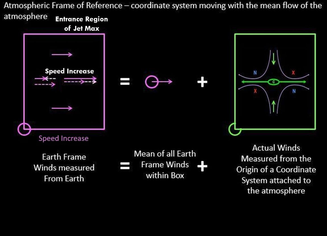
The atmospheric frame of reference moves with the mean flow of the wind. The atmosphere is always in motion but those motions are not uniform around the globe. It is best to just consider a volume the size of a synoptic weather system. The absolute vorticity field can assist in identifying this but I will leave that for another day. 

In the accompanying graphics, the earth frame winds within the purple box are those measured from a given point attached to the globe. The average of all of these earth frame winds is the mean motion of the atmospheric frame of reference and the first term to the right of the mathematical "equals" sign. 

The winds as measured within the atmospheric frame of reference are those winds within the green box to the right. The relative winds within the atmospheric frame of reference shape the clouds that we observe. Mathematically, the vectors must add up and be identical on either side of the "equals" sign. 

The first graphic has calm winds within the atmospheric frame of reference. The cloud shapes must be simply translated across the landscape with the mean winds. 

No relative Motions within the Green Box of
the Atmospheric Frame of Reference

The next few graphics have a wind in the earth frame of reference that simply decreases a bit. Such a change solely in wind speed can be difficult to measure but the impacts on cloud shape are astounding. The result for me back in the early 1980s was the "Deformation Zone Conceptual Model" that Roger Weldon was talking about. A simple decrease in wind speed results in an obvious line perpendicular to the wind and four vorticity/swirl centres that are both paired across that line and companions on either side of the flow. I struggled to develop clear and concise terminology that was meaningful to meteorologists and the general public as well. The relative spins of these four vorticity/swirl centres control the shape of the line and reveal everything about the meteorology within that portion of the atmosphere. The rest of my meteorological career was defined by that single night shift. 

A Slight Decrease in the Wind Measured in the Earth Frame
of Reference Yields a Convergent Flow in the 
Atmospheric Frame of Reference. 

The Convergent Flow in the Atmospheric Frame of Reference 
becomes the Axis of Contraction in the Deformation Zone
Conceptual Model

Deformation Zone Conceptual Model

The next few graphics have a wind in the earth frame of reference that simply increases a bit. That pattern within the atmospheric frame of reference that develops is very different. A linear structure develops but it parallels the wind direction. The line is still a deformation zone but the conceptual model is rotated by 90 degrees. 
A Slight Increase in the Wind Measured in the Earth Frame
of Reference Yields a Divergent Flow in the 
Atmospheric Frame of Reference. 


The Divergent Flow in the Atmospheric Frame of Reference 
becomes the Axis of Dilatation in the Deformation Zone
Conceptual Model

Deformation Zone Conceptual Model

This leads me back to my first study of fluids and patterns which started with the family purchasing a fibreglass canoe around 1964. A single stroke of the paddle created a situation where the water increased in speed and then decreased while the canoe was propelled in the opposite direction - Newton's Third Law - for every action (force) in nature there is an equal and opposite reaction. The lines that I witnessed in the fluid frame of water were exactly the same as those within the atmospheric frame of reference. Duckweed is the canoeing equivalent of water vapour in the atmosphere. 
The Deformation Zone (DZ) Ahead of the Paddle Push
 is perpendicular to the Flow while
the DZ Behind the Paddle Push Parallels the Flow...
Intuitively Obvious if you are a Canoeist

An identical situation is also extremely important in the atmosphere - the jet streak or a local maximum in wind speed along the jet stream. Dr. James Moore provided the following conceptual model and graphic. I added the deformation zones. 


If the local wind speed is increasing, the deformation zone must parallel the flow. If the local wind speed is decreasing, the deformation zone must form perpendicular to the flow. The lines in any fluid form within that medium reveal everything to anyone who is willing to place themselves within the fluid frame of reference.

As a result, the observation of a deformation zone that is perpendicular to the flow requires that the flow is decreasing in that region of the atmosphere. A deformation zone that parallels the flow similar to baroclinic zone cirrus must be found in a region of the atmosphere where the flow is increasing. These are simple ideas but now you know how and why they work. 

As an illustration, applied to cirrus uncinusis. The name cirrus uncinus is derived from Latin, meaning "curly hooks". Also known as mares' tails, these clouds are generally sparse in the sky and very thin. The clouds occur at high altitudes, at a temperature of about −50 to −40 °C (−58 to −40 °F). The 
curl at the end of the band of cloud is associated with a decrease in wind speed. Within the atmospheric frame of reference, a decreasing wind speed requires deformation zones perpendicular to the direction of the flow. With moisture typically on the warm side of the jet stream which corresponds to the anticyclonic companion, you might notice that the majority of the mares tails are anticyclonic swirls.

Warmest regards and keep your paddle in the water,

Phil the Forecaster Chadwick

Wednesday, October 19, 2022

Tom Thomson Was A Weatherman - Summary As of Now

Thomas John Thomson (born 5 August 1877 in Claremont, ON;
died 8 July 1917, almost 40 years old )  circa 1905–10.                 
I started doing presentations about the art and science of Tom Thomson in the mid-1980s. I did not keep count, but the number of presentations certainly numbers in the hundreds. This mountain of material has grown into a book that is now being blogged a bit at a time. 

Thoreau MacDonald (1901-1989), the son of JEH MacDonald of the Group of Seven, was also a friend of Tom, and he wrote:

“Thomson’s work would be a fine study for some competent critic, but anyone attempting it should be familiar, not only with every phase of his work but with the country too, lakes, rivers, weather; have them in his bones … “

I prefer to be positive... being critical is not my style, but my natural science background brings fresh information to the Tom Thomson catalogue raisonné. This project will take some years to complete, but I am in no rush. 

In the draft of my "Tom Thomson Was A Weatherman" book, I included several chapters describing the meteorology and natural science employed to better understand his art. This information has already been written in "The Art and Science of Phil the Forecaster" blogs, which I have been compiling for many years. If you should encounter a term or concept that I do not adequately explain within the context of a particular Thomson work, a search of this site will certainly yield the answers. I will typically include linked references to the required background information with each painting. 

The following is a list of the Blog entries to date, accompanied by a representative image and a linked title to the Blog. Some paintings require more than one blog post to fully explain. Tom accurately painted the truth of what he saw. 

Arthur Lismer, his friend and Group of Seven member, described Thomson as someone who "sought the wilderness, never seeking to tame it, but only to draw from it, its magic of tangle and season." That wilderness put the "wild" into his art. 

Blodwen Davies included in the 1967 publication "Tom Thomson: The Story of a Man Who Looked for Beauty and for Truth In The Wilderness" that  Tom Thomson had remarked: "Someday they will know what I mean." Hopefully, that day has arrived.

Note: Miss Blodwen Davies's passed in 1966, but she had previously sought help from Group of Seven artist A. Y. Jackson, who had written the Foreword to the first self-published version in 1935. That first printing was limited to 100 copies, and the 1967 republished version of that scarce book is available to a larger audience. 

Thank you for your interest. These posts have been a lifetime in coming. 

Tom Thomson Was A Weatherman


Tom’s Tornado!


Tom’s Tornado Two - Some Science

Tom’s Tornado Three - Some Art


Tom's Summer Clouds


Thunderhead: Pink Cloud over a Lake - Summer 1916


Lightning, Canoe Lake: Summer 1915


Tom Thomson’s Last Weather Observation


Updated May 2024


Tom Thomson's "A Northern Lake" Was the Belt of Venus Sunrise
Tom Thomson's Black Spruce Autumn 1915 observation of a cold frontal passage
Tom Thomson's "First Snow in Autumn", Fall 1916 - Light and fluffy snowsquall snow laden on drooping balsam fir branches


Tom Thomson's Approaching Snowstorm - actually a snowsquall as contrasted with a synoptic scale winter storm.
Tom Thomson's After the Sleet Storm, 1916 - published 25 years after the 1998 Ice Storm and it brings back many personal memories.
Tom Thomson's Burnt Land at Sunset - the dynamics of the weather was Tom's inspiration. 


Tom Thomson's Afternoon: Algonquin Park, 1915 Studio Work in The Shack - Tom painted this in late November 1914 and one of his last works in the Studio Building before heading to the Shack. 

Tom Thomson's The Morning Cloud, 1913 Plein air sketch from the autumn of 1913. What an unusual cloud!

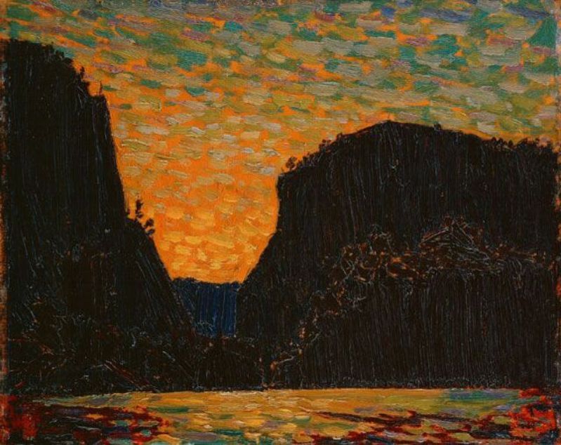
Tom Thomson's Petawawa Gorges Night 1916. The "fallout" from Creative Scene Investigation requires that "Petawawa Gorges, Night" along with the alternate titles "Sunset behind Cliff" and the "The Coming of the Night" need to be revised. The reality is that Thomson was a morning person and this painting was certainly a sunrise observation of light and shapes.


Islands, Canoe Lake, 1916. Some interesting meteorology and history. Tom Thomson spent some time at Canoe Lake in October 1916 after spending the summer being a forest fire ranger at Achray on Grand Lake. 

Landscape with Snow, 1916. Even more interesting meteorology and history. The flip side of Tom Thomson's “Rising Mist - Heavy Skies” Autumn 1916

Smoke Lake - Summer 1915. This is another of Thomson's double-sided panels and there is a story of weather and confusion behind it. 
The flip side of Northern Lights 1915.

Northern Lights 1915. The flip side of Smoke Lake - Summer 1915. Tom observed and recorded space weather as well. 

Path Behind Mowat Lodge, Spring 1917, The gift to Daphne Crombie includes a lot of interesting science as well. 
Canoe Lake Spring, 1917 - an afternoon sketch with the centre of the low-pressure area nearby turns into much more with the assistance of Roy MacGregor
Moonlight Over Canoe Lake 1916 A tremendous amount of science in this plein air panel...
Sunset Spring 1916 ... the view may not be what you think it is! 
Spring Sunset, Algonquin Park Spring 1916 also holds some surprises... this story was never told.
The Marsh, Early Spring 1916 - a challenge to place the location but not in the weather.


Sunset, Summer 1915. There is a lot of science in this painting and it was a spring sunrise (not sunset) painted around May 24th, 1915...

Sunset Sky, Summer 1915 was indeed a sunset but was observed in the spring.  
Sunset Sky, Spring 1915 was a spring painting but was actually a sunrise. This post has been years in the making and I have never included it in a “Tom Thomson was a Weatherman “ presentation. The last two posts lead to this one - a trio if not a quartet of skyscapes within a single event. 


Morning, Algonquin Park, Spring 1915. It was a dark and stormy morning at Canoe Lake that spring morning in 1915 when a cold front was crossing Mowat.
Ragged Pine, Spring 1916. Actually a black spruce but that is only the tip of the true story. 

Rocky Shore and Sky Summer 1915  The foreground was the devasted shore of Canoe Lake left behind by the forest industry.. lost habitats. The sky was full of interesting science!


Hot Summer Moonlight Summer 1915. Actually, a view overlooking Grand Lake from Achray possibly at 9 pm on May 11th, 1916... The waxing quarter moon spread the glow over the choppy waters of Grand Lake while a spring storm approached. And the story was recorded in Tom's brushstrokes. 

Sunset by Lake Alternate title: Sunset Summer 1915 Quite the back story behind this painting... 
Blue Clouds, Wooded Hills, and Marshes Summer 1915. Science Tuesday shines a new light on this painting... perhaps from 1916. 
Stormy Sky Summer 1915. Actually a split cold front mid-morning in spring. 
Fire-Swept Hills Summer or Fall 1915. Long-range Forecast: Continuing hot and dry for the rest of the 21st "Century of Fire". 


Ragged Lake Alternate titles: Northern Lake; Ragged Creek Fall 1915
Autumn Clouds Fall 1915 Dynamic cloud shaped by the wind bathed in the light of sunset tell an intriguing story of science and the weather.
Evening Cloud Alternate titles: Evening Clouds; Storm Cloud; Storm Clouds Fall 1915 Hers is the real story... cumulus congestus at a cold frontal passage wearing the Belt of Venus...

Artist's Camp, Canoe Lake, Algonquin Park Alternate title: Night Camp Fall 1915. There is a very interesting story behind the white "balloon silk", state-of-the-art tent. 
Tea Lake Dam Fall 1915 certainly painted in the spring with logs going to market - probably 1916. 
Moonlight Fall 1915 Actually painted in the spring of 1916... on the evening of April 18th about 18 hours before Ragged Pine, Spring 1916.
Abandoned Logs Fall 1915 Those logs were not abandoned in the spring of 1916 when Tom observed the log drive along Carcajou Creek. The tall pile of logs was a landing piled high by the hard-working lumbermen. 
Sketch for "The Drive" Fall 1916 After painting Abandoned Logs Tom probably strolled 100 metres along the western bank of Carcajou Creek to were the lumbermen were actively guiding logs through the sluiceway of the dam on the May morning in 1916. 
Sandbank with Logs, Summer or fall 1916  There is actually quite an interesting story behind this tangle of timbers... 
Bateaux Summer 1916 Actually Pointers and there is quite a story to be told. 


Yellow Sunset, Spring or Summer 1916 There are two sides to this very interesting story!


View from the Top of a Hill 1916. This is the flip side of "Yellow Sunset".  Together they tell quite a story. 

Aura Lee Lake Spring 1916. Aura Lee Lake which is now known as Laurel Lake was definitely not an arduous canoe trip downstream from Little Cauchon Lake where Tom and his friends were fishing and painting up a storm!
Early Spring in Cauchon Lake, Spring 1916. It was a challenge to locate the correct rocky face... still looking.
Algonquin Park, Spring 1916. There is a lot of science in this small panel... and we can even guess where Thomson was sitting. 
Birches, 1916 The sky was the real star of this painting.
The Lake, Bright Day, Fall 1916 The clouds tell the story. 

Spring Break-up, 1916 The underlying story is of a clear-cut forest with nothing to hold back the spring floods. The cracks in the shoreline ice hold those clues.
Portage, Ragged Lake Spring 1915 This is a story of icy swirls. Tea-stained ice pans swirling in the turbulent waters of the outflow from Ragged Lake during the spring flood.
Red Pines, Little Cauchon Lake, Algonquin Park, Spring 1916 The story can be discovered by strolling behind the Red Pines to take a closer look at the sky. 
The Sketch for the Jack Pine 1916. Imagine a solitary tree exposed on the rocky shore of a northern lake facing the elements alone. Simply staying alive was a victory. Thomson captured that iconic message in oils. "The Jack Pine" has become the metaphoric touchstone of the Canadian experience. Like the seeds of a torched Jack Pine, Thomson's art could only be sown after his death to inspire the next generation of artists. 
Little Cauchon Lake, Spring 1916 A story from the fishing trip of late April 1916. TT-134
Spring Foliage on the Muskoka River The tale of Thomson's Spring Foliage evolves into the story of three paintings completed on an early summer afternoon... TT-135


Tom Thomson's "Smoke Lake" 1912. The story of a multicellular thunderstorm painted from Molly's Island on Smoke Lake looking southward.  TT-199


Tom Thomson's "The Hill in Autumn" 1914. My first diagnosis of "The Hill in Autumn" really troubled me! Some subtle inconsistencies bothered me enough that the story did not get published in the first go-round. Tom painted the tilted vortices of mares' tails in the azure skies - they looked like birds.  


Tom Thomson's "Sunset and Shore", 1916. TT-Post 113. A painting, probably no one has seen before, from Dr. MacCallum's bequest to the National Gallery. The location and weather can be exactly determined and will follow upon completion. 


The Waterfall TT-Post 145
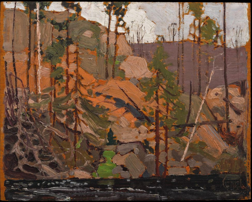
Pine Cleft Rocks Spring 1916 TT-Post 136
Little Cauchon Lake, Spring 1916 TT-Post 137
Landscape, Sunset Spring 1916 TT-Post 138
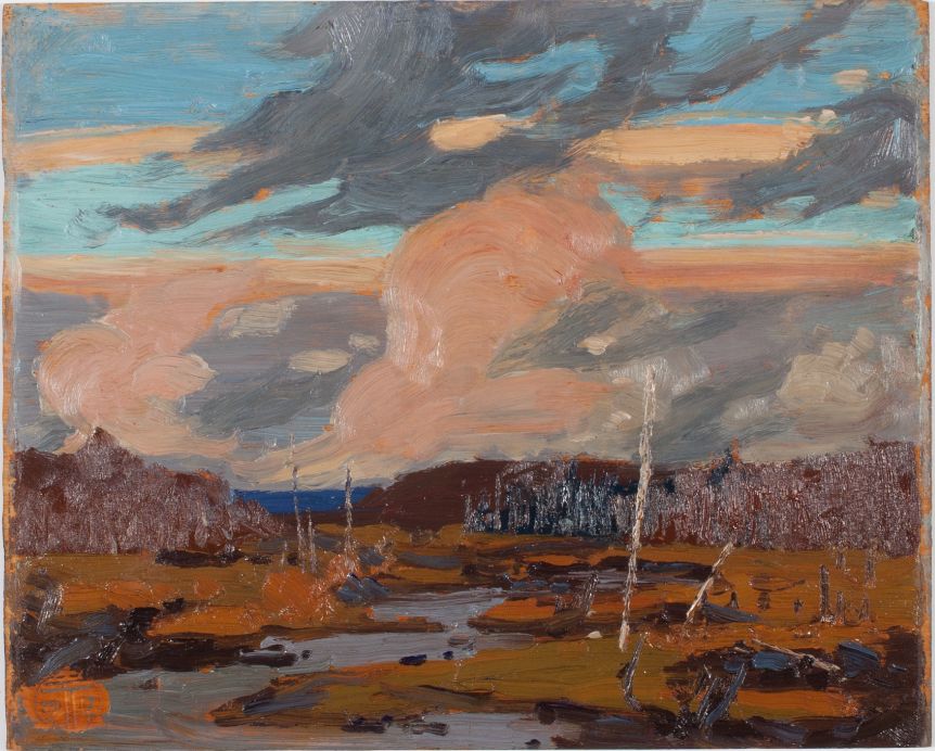
Tamarack Swamp Fall 1916 TT-Post 139
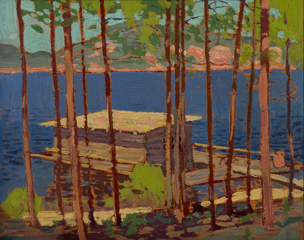
Boathouse, Summer 1916 TT-Post 140
The Dead Pine, Fall 1916 TT-Post 141

Autumn, Petawawa, Fall 1916 (1916.94) TT-Post 142


Algonquin Park Vista, Fall 1916 (1916.101) TT-Post 143


Spring Lake, Fall 1916 (1916.117) TT-Post 144


Pine Tree, Summer 1916 (1916.84) TT-Post 146


Phantom Tent, Fall 1915 TT-Post 90
Tamaracks Alternate titles: Purple Distance; Yellow Trees Fall 1915 TT-Post 91
Tamarack Swamp Alternate title: Tamarack Fall 1915 TT-Post 92
Round Lake, Mud Bay Alternate title: Geese, Round Lake, Mud Bay Fall 1915 TT-Post 93
November Day Alternate title: A November Day Fall 1915 TT-Post 94
Sunset, Canoe Lake Alternate title: Canoe Lake Fall 1915 TT-Post 95
Northern Lake Alternate title: Northern Lake, Spring Summer 1916 TT-Post 96
Poplars by a Lake Alternate title: Lake Through Trees Summer or fall 1916 TT-Post 97
Petawawa Gorges Alternate titles: Cliff Landscape; Storm Over River Fall 1916 TT-Post 98
View from a Height, Algonquin Park Fall 1916 TT-Post 100


TT-Post 101
Somber Day Fall 1916 TT-Post 102

Ragged Pine Fall 1916 TT-Post 103
Birch by a Lake, with Big Cloud Alternate titles: Birch by a Lake; Birches; Clouds over a Lake Fall 1916 TT-Post 104
Autumn, Algonquin Park 1916 TT-Post 105
Lake in Autumn Alternate titles: Late Afternoon?; Swamp in Fall? Fall 1916 TT-Post 106
Canoe Lake, Algonquin Park Fall 1916 TT-Post 107
Pink Clouds Fall 1916 TT-Post 108
Wild Geese: Sketch for "Chill November" Alternate titles: First Snow Ducks; Sketch for "Chill November" Fall 1916 TT-Post 109
Sunset, Canoe Lake Fall 1916 TT-Post 110


TT-Post 111


The Pointers, Winter 1916–17 (1916-1917.13) TT-Post 112


The following final posts describe how several paintings might be connected in time and space.


Tom Thomson and the 1917 May Two-Four Weekend (coming)

The ability of nature to inspire and heal can be magical. The preceding articles were never intended to teach the incredible complexities of physics or meteorology. The goal was simply to encourage the reader to look at the natural world from a fresh perspective - to appreciate the magic of nature and perhaps become a "weather walker" and a protector of the environment. 

Tom was inspired by the supernatural that he witnessed through his brief forty years. That world is being threatened by unsustainable consumption, which is the source of all environmental issues. The reader inspired by Tom's art and nature might be moved to take action for future generations as we careen through the Sixth Mass Extinction and  Earth's Loss of Biodiversity. That was the other goal of this effort disguised as art history. Art and science can be compatible. 

Of course, you may simply wish to enjoy the art of Tom Thomson and that is absolutely fine as well - even encouraged! As Claude Monet said: “Everyone discusses my art and pretends to understand, as if it were necessary to understand, when it is simply necessary to love.”

I always left the last word for Tom Thomson at the end of every "Tom Thomson Was A Weatherman" 
presentation. On Saturday, July 7th, 1917, the day before he died, Tom wrote to his patron Dr. James MacCallum: "Will send my winter sketches down in a day or two and have every intention of making some more..." Tom was not finished with his artistic journey! Neither am I!

Tom Thomson May 1917 at the campsite firepit. The last picture of Tom that I am aware of...

There are many more articles to come but it takes time to translate the "Tom Thomson Was A Weatherman" book into blogs .. and I still need to follow my own artistic journey -  and catalogue raisonné as well. I prefer to tell my own story so that any mistakes are my own. 

Warmest regards and keep your paddle in the water,

Phil the Forecaster Chadwick

PS: I once corresponded with Ross King, the author of "Defiant Spirits" and he believes that the "ancient question of St. Hilary of Poitiers—“Who can look on nature and not see God? ”—can be given a Canadian twist. Who can look on nature and not see Tom Thomson?" That phrase does indeed sum up the art and science of Tom Thomson.